Tuesday, 14 January 2014

Keswick Mountain Festival 2014

The dates of the KMF 2014 are 15th - 18th May.


You'll notice that the festival is only on for four days this year, Thursday to Sunday...Wednesday has been dropped. There's new management involved in the festival this year which unsurprisingly meant a hike in price to providers, though KR with their customary restraint have not passed this on; our charges remain the same as last year...£20 per walk. New management, I'm assured, means increased numbers attending the festival which will more than make up for increased charges...Hmmm.

I hope you're coming to the festival this year and here to whet your appetite is KR's programme for the four days. More fulsome information is available on the KMF website where, from 20 January, bookings can be made at... http://www.keswickmountainfestival.co.uk/activities/category/hike


Thursday 15 May.

1. Skiddaw's 7 Wainwrights...with Halle and Alison

2. Not the Fairfield Horseshoe...with Cathy

3. Cam Crag Ridge and Rosthwaite Fell... with Pete and Lyn

Friday 16 May.

4. Robinson, Hindscarth and Dale Head ridge...with Halle and Alison

5. Easdale Tarn and Blea Rigg...with Cathy

6. Buttermere to Keswick, over the tops...with Pete and Lyn

Saturday 17 May

7. Catbells and the Lakeshore...with Halle and Alison

8. Blencathra and Bannerdale Crags... with Cathy

9. Pavey Ark and the Langdale Pikes... with Pete and Lyn.

Sunday 18 May

10. Grisedale Pike...with Halle and Alison

11. Bessyboot and Glaramara...with Cathy. (Hike and Navigation)

12. The Dodds; Stybarrow Dodd to Clough Head...with Pete and Lyn


You can see pictures of all these walks by clicking on the list in the right hand column.


Monday, 6 January 2014

A photo taken down by the lake on Boxing Day

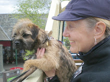
Paul Ross holding Nettle, Marea with Bess, Pete with Bella and Dennis with two retired hound trailers.
Some of you may remember the old days of Keswick Rambles when Paul Ross was one of our leaders and then he decamped to Colorado for about 14 years, well he is back and still keeping Jack Russell terriers so we all went for a hike together for old time's sake. Paul is still a very active climber and he is well known around here for putting up many new routes on the local crags and also loads of them in the US too.

We have also confirmed the hikes we are doing for the Keswick Mountain Festival 2014 and the dates for that are 15th to 18th May.  The organisers have cut the festival down from 5 days to only 4 so it starts on the Thursday until the Sunday.  I will post up the hikes very soon but there are not as many hike providers as in previous years so you may find that you need to book well ahead to make sure of your place. Don't say I didn't warn you.

Sunday, 10 November 2013

Wetherlam

Above Little Langdale Tarn.

Our expedition to climb Wetherlam earlier this week was also intended as a reconnaissance of the area to help us decide on routes for our two-day expedition which we plan this summer. The dates on which this will take place are Wednesday 2nd and Thursday 3rd July. We've not yet found suitable accommodation for the two nights but we're researching this right now.
Lyn, Pete and Bella set off up the Greenburn Valley in bright sunshine but soon found themselves in deep shade in the gloomy valley, the sun being low in the south, behind the mountain.

Deep shade in the valley, Langdale Pikes in the distance.

Our objective, Wetherlam 762m/2,500ft, forms the southern wall of the Greenburn valley. We walked up as far as the ancient Greenburn mine workings, the ruins of which stand just below the 1,000ft contour some way up the valley then turned onto a path that led up the steep fellside.


Above the Greenburn mine workings.


A sporadic path led upwards through rough boulder strewn terrain passing by several old mine workings until we reached the col at about 500m between Birk Fell and Wetherlam where, though the path improved, the going became increasingly rocky.


Ascending Wetherlam Edge
Wetherlam Edge, which leads to the summit, was still in deep shade, far below Birk Fell was enjoying the November sun.  We seemed to have picked the coldest and gloomiest route of ascent possible, there was no wind however the temperature continued to spiral downwards as we gained height and the path became  increasingly icy. We turned back about 120ft short of the top as the path was dangerously iced up. From now on this winter the crampons will go in the rucksacks as a matter of course, without them retreat was the safest course.  We plan a return to Wetherlam with full winter gear...soon.


View from Birk Fell on the descent.

We walked over Birk Fell intending to descend the ridge beyond in the sunshine rather than turning down into the sunless valley.  We followed the wall which you can see going straight ahead in the distance.


View from the wall towards Wrynose Pass.

We followed the wall over the next top (405m) expecting to pass through old quarry workings marked as disused on the map, but we came to the edge of the workings and found them impassable. We retreated back along the wall to a gate then walked down into the workings by an easier path. The quarry turned out to be a working one and we found that we had little option but to follow the mine road that led down to High Tilberthwaite. It was a bit out of our way and not quite what we'd planned but we followed a good track that led directly back to Little Langdale and were back at the car in an hour. It was a very useful recce, we learned a lot, and a great walking area too we decided for the two-dayer in July...we'll be back.

If you're interested in joining us for the two days in July ring or e-mail us. You can stay in a hotel, hostel or camp, it's up to you, I'm sure it'll be fun.