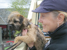
We camped at Ullapool on Wednesday night knowing that we had only one chance at Seana Bhraigh as we knew that the weather would be reasonable for most of Thursday but was going to take a turn for the worse later in the afternoon, but would we reach the summit first?
We made our preparations and went to bed in our small mountain tents (Lyn shared with Bella) and snuggled down. It promised to be a peaceful night and we dropped off to sleep only to be rudely awakened at 1.30am when four drunken Scottish peasants stumbling back from the boozer kicked over their stove as they groped noisily around their tent looking for their beer. The hubbub continued for an hour until the beer was gone..."One for the road" shouts Jock at 2.30am, then at last... silence. Lyn and Bella had just dozed off when all hell broke loose over by the Ferry Terminal. It was the 3am Ullapool ferry coming in to dock. Did you know that it takes about an hour for a ferry to unload with lots of grinding and metallic banging noises? Then just as you're dropping off again the whole business goes into reverse and the ferry noisily loads up and leaves. At 4.30am the shrill trilling of a blackbird heralded the dawn, a cuckoo cuckood, wood pidgeons cooed, an owl hooted and every feathered songster for miles around joined in the chorus. It was a relief when the alarm rang at 7am and delivered us from the cacaphony of the night.
Despite the disturbances of the night we stuck to our plan and set off at 8am for the car park on the A835 at Inverlael. Seana Bhraig is a very remote Munro, perhaps the most remote of them all and it is a long walk in from Inverlael. Snow covered the tops of the nearby mountains and we had packed our Kahtoola crampons just in case. The track through the forest soon climbs steeply out of the woods onto the ridge of Druim na Saobhaidhe then a good stalkers path goes east at 450m across the barren moorland towards the distant west ridge of Eididh nan Clash Gaela 928m.
 |
| Lyn crossing the Allt Gleann a Mhadaidh with snowy Clash Gaela in the distance. |
Two hours later and we were still plodding on a stalkers path through rough moorland dotted with streams and lochans. We stopped for a break and sipped a warming cup of tea as we surveyed the scene. But no time was left to ponder for long as this was a tough mountain.
 |
| Coire an Lochan Sgeirich |
Our stalkers path took us past the tiered string of lochans in the Coire an Lochan Sgeirich, below the precipitous north face of Clash Gaela, towards the 750m col just beyond the horizon which would give us our first view of remote Seana Bhraigh.
 |
| The summit of Seana Bhraigh comes into view. |
We passed the coll and headed down through pathless boggy peat towards Loch a Chadha Dheirg which nestles at the foot of Seana Bhraigh and marks the start of the climb to the summit far above.
 |
| Cliffs above the Cadha Dearg with the summit of Seana Bhraigh in the far distance |
 |
| View east from the summit over Loch Luchd Coire towards Creag an Duine. |
The views improved as we gained height and we could see over the top of the cliffs down to the valley floor 2800 feet below. I was struggling to keep up because the wind was strong. Pete was ahead as we neared the top and I shouted and asked him to wait because I wanted Bella to have her coat on which was in my rucksack; she needed it now the cold was intense.
 |
| Bella in her coat with Pete on the summit of Seana Bhraigh 927m; Pete's penultimate Munro |
We reached the summit in just over 5 hours at about 2pm as the clouds were darkening... soon the first icy snowflakes hit us, there was no time for more than a quick photo and a slurp of tea and then it was. "Let's get out of here". We returned along the way we came in a snowstorm and took no more photos.
 |
| End of the trail, with Seanna Bhraigh and Bella "in the bag". |
Bella was tired on the return, so we decided it was time for her to go in my rucksack. We emptied my stuff into Pete's and swopped sacks as she is slightly heavier than all our gear put together and set off again. I took my Buff off and put this 'bonnet' on her head to keep her warm against the snow which was blowing horizontally now.
We'd left the snow behind by the time we reached the forest road again. We had been fully ten hours on the hill and walked the best part of eighteen miles...this had been a hard Munro and one we were well pleased to have got in the bag.