Monday, 27 July 2015

Snowdonia, Pen yr Ole Wen and Carnedd Dafydd

Tryfan 915m from the bridge over the Afon Denau that leads to Pen yr Ole Wen


Pete Lyn and Bella have just returned from six days in Snowdonia and here are some of the photos that were taken when they climbed Pen yr Ole Wen 978m and Carnedd Dafydd 1044m, two of the fourteen Welsh 3,000 footers.
In 2016 we plan an expedition to Snowdonia as our annual "Overnighter" and our recent outing there was to some extent a recce for this trip. Plans for this are in their infancy yet but if you're interested in taking part we'd be interested to hear from you. Full details will be available later this year.


The East ridge of Pen yr Ole Wen above Ffynnon Lloer has one scrambly section easily negotiated, Tyfan beyond. 

Llyn Ogwen with Tryfan and the Glyders beyond from the slopes of Pen yr Ole Wen.


Ffynnon Lloer nestles in Cwm Lloer, between the East ridge of Pen yr Ole Wen and the southern slopes of Carnedd Dafydd. Beyond can be seen the summits of Pen yr Helgi Dhu, Pen Llithrig y Wrach and Crimpiau above Capel Curig.

Lunch on the summit of Pen yr Ole Wen with a view over the Menai Straits to Anglesey

It's a short walk along the ridge from Pen yr Ole Wen to Carnedd Dafydd, this view looks back from the latter peak towards Ole Wen. Snowdon, in the distance, has her head in the clouds.

The summit of Carnedd Dafydd 1044m with Anglesey in the distance.

Carnedd Llywelyn 1064m from Carnedd Dafydd. We descended from the col between the two hills down grassy slopes to Cwm Lloer.

The grassy southern slopes of Carnedd Dafydd made for an easy descent to Ffynnon Lloer. Beyond the lake is the rocky  East ridge of Pen yr Ole Wen our ascent route. Far below lies Llyn Ogwen, flanked on the left by Tryfan, the Glyders form the far horizon.
 

Sunday, 12 July 2015

Across the Northern Fells, Day 4.

Pete takes a picture of the group on the Cumbria Way in the Caldew Valley with Skiddaw House beyond.


A traverse of the northern fells from Keswick to Caldbeck was the aim of day four of our walk, however the weather was hot and time was of the essence so a decision was taken to shorten the route and to start at Mosedale Head and finish at Fell Side, just short of Caldbeck where we could be picked up and transported back to Keswick. The route, over Knott 710m, the highest point of the route and Great Sca Fell, was now a more manageable 11.5km and missed out the low level section of the Cumbria Way between Keswick and Skiddaw House.


A track rises from the valley of the Caldew, leaving the Cumbria Way, on which we'd walked from Mosedale Head, far below.

The track up Cocklakes becomes sporadic about 550m though the going is easy as the slope eases off towards the summit plateau.  Bowscale Fell forms the backdrop to the walkers on the steep ascent to Coomb Height 620m. 


On the summit plateau heading for Coomb Height for a well deserved lunch. 

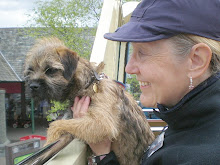
Pete, Lyn and Bella the Border Terrier on the way to the summit of Knott. 

The summit cairn on Knott 710m. The group are looking SW towards Lonscale Fell and Skiddaw.

Descent from Great Sca Fell651m down the ridge of Yard Steel into Roughten Gill far below.

A not too desperate stream crossing in Roughten Gill was achieved with dry feet by all.

The end of a perfect day and a great four day expedition.

Langdale to Borrowdale, Day 3.

Pete and the group ascending the path up Stickle Ghyll from the NDG.


The third day of Pete's Cumbrian Way epic took the group from the New Dungeon Ghyll in Great Langdale over to Borrowdale, a distance of 12km by way of Stickle Tarn, Pavey Ark and High Raise 762m, the highest elevation of the day's walk. From there we made a steady traversing descent N past Long Crag towards Greenup Gill which we crossed at the island with a sheepfold on it below Eagle Crag. Here we joined the C2C footpath which took us down the valley to Stonethwaite and the open top bus to Keswick.


View down Stickle Ghyll towards Great Langdale and Lingmoor Fell beyond.

Below the precipitous slopes above the left bank of Stickle Ghyll the path snakes upwards towards Stickle Tarn.

A pause at Stickle Tarn with the mighty Crags of Pavey Ark as a dramatic backdrop, the mist is lifting as the sun breaks through.

Stickle Tarn peeps out below the rocky summit of Pavey Ark 700m. Below in Langdale the sun puts in an appearance. 

A whole new vista unfolds to the N from the summit of High Raise 762m. Borrowdale comes into view with Bassenthwaite Lake far beyond and Skiddaw, touching the clouds, forms the skyline.

Lunch stop in the wind-shelter at the summit of High Raise. On the far left Pike o' Stickle is in view; on the right the long ridge of Rossett Pike runs SW towards mist shrouded Bow Fell.

Cam Crag and the rugged E face of Glaramara above Langstrath form the backdrop to our descent from High Raise past Long Crag towards Greenup Gill.

Crossing Greenup Gill at the sheepfold on the island below Eagle Crag.

The last half mile with Stonethwaite in view

Saturday, 11 July 2015

Cumbrian Way, Over the Tops to Langdale.

Ascent from Coppermines Valley, Swirl How on the skyline ahead.

On the second day of our epic adventure we walked from Coniston to Great Langdale 12.5km, the highest point of the day was Swirl How 770m. We descended to the Three Shires Stone on Wrynose Pass then walked N. over the pass between Cold Pike and Pike of Blisco past Red Tarn and down into Langdale and a welcome pint at the ODG.


Kennel Crag above Levers water is ahead, beyond the old mine buildings, the route went up the right hand side of the crag on a stone causeway just visible to the left of the stone built buttress in the foreground. 

The group take a break beside the old mine buildings above Coppermines valley.

Looking S. down Red Dell Beck into Coppermines valley

Ascending the stone causeway that leads from Red Dell past Kennel Crag to Levers Water 410m

The hot dry weather had left Levers Water at low ebb. Beyond the reservoir are Great How Crags on the E face of Swirl How. 

Ascent from Levers Water towards Swirl Hawse the 620m col between Swirl How and Wetherlam.

Prison Band is the steep ridge that ascends from Swirl Hawse to the summit of Swirl How. Levers Water is in view below and far beyond is Coniston Water. 

The group with Pete and Bella on the summit of Swirl How 770m

Great Carrs from Swirl How. To the right of the peak of Great Carrs, far in the distance can be seen Red Tarn, our objective before descent into Langdale.

Red Tarn lies in the dip between Pike of Blisco and Cold Pike, beyond are Crinkle Crags and Bow Fell. Our descent into Great Langdale is to the right following the outflow of the tarn, Browney Gill.

Red Tarn looking back along our route towards the Coniston fells


The steep descent down Browney Gill into Oxendale, the view dominated by Pike o' Stickle above Great Langdale.

Four Days on the Hill in July

The beginning of the adventure at Stonestar in the Duddon Valley 10.30am Tuesday 30/6


Between Tuesday 30 June and Friday 3 July Pete and his intrepid group of walkers made their way N to S on a high level route across the Lake District from the Duddon Valley to Caldbeck. The route offered an immense variety of differing landscape, we were often off the beaten track, on rough paths and tracks, sometimes on no path at all, there were steep rocky ascents, bogs, head-high bracken and bugs and midges to battle with, there was never a dull moment. The weather was kind to us, not a drop of rain and a dry baking heat and clear skies for much of the four days we were walking, I lost a few pounds and I'm sure we all did.

Day One took us from Stonestar in the Duddon Valley to Coniston, 15.5km over the tops of Great Stickle, Stickle Pike and Caw which at 529m was the highest top of the day though the highest point of the day was the crest of the Walna Scar Road 600m. The accompanying photos were taken by Judith and Pete, they are in chronological order and should provide both a snapshot and a flavour of our four day adventure...


Great Stickle 305m our first top of the day.

Stickle Pike 375m Reigning Peak of the Dunnerdale Fells


Alan scrambles the Pike the hard way.

Pete takes a "selfie" on Stickle Pike  

Stickle Pike looking N. towards Caw and the Coniston Fells

A break between Caw and Pikes, layers are coming off 

Looking N. from Pikes towards White Maiden, this was a pathless section though a good track below led to the Walna Scar Quarry. 

Looking S. to Caw from the Walna Scar Quarry


Pete and Bella, Colin, Ingrid, Alan, Tommy, Julie and Judith who took this selfie of the group at the Walna Scar Quarry,
Waiting for stragglers at the bridge over the Torver Beck on the Walna Scar Rd.